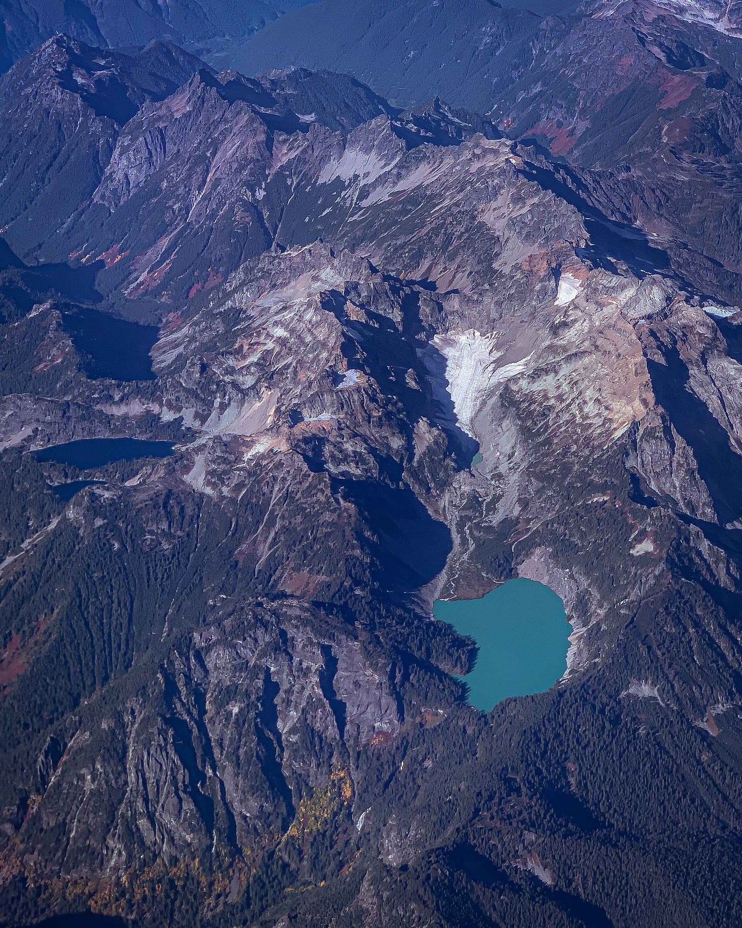
On my flight back to Seattle last month I spotted a bright teal lake in the mountains below me out the plane window. I took a picture.
When I got home, I spread out maps on the living room floor and looked to see if I could find a way to hike to it. Pretty easily, I found one. I knew that I was looking north, and that the lake was near Glacier Peak, easily identifiable from the plane. The water color was different than all the lakes around it, which meant it had to be fed by a nearby Glacier and full of glacial till.
I was looking for a Glacial Lake, southwest of Glacier Peak, that matched the shape of the lake I had taken a photo of— only Blanca Lake fit the bill.

Hiking to Blanca Lake: Henry M. Jackson Wilderness
The odds that the lake I picked out from the plane was doable as a day hike were so, wildly low that I could not believe my luck. I packed up my car and a friend and we headed out to see if we could find the teal lake I flew over on the way to Seattle.
A note about the Blanca Lake Trail: This area is currently recovering from overuse, and all off-trail areas are closed. While you used to be able to camp at Blanca Lake, the area is now closed to camping and is day-use only around the lake. You can, however, camp at the sites up the ridge near Virgin Lake. With the exception of the Sleeping Bear Dunes in Michigan, this is probably the most amount of people I’ve seen breaking clearly posted rules in one spot. While there was some trash on the trail (we picked it up and packed it out), there was one group headed to camp at the closed campsites anyhow, and two groups droning despite it being clearly posted at the trailhead it’s illegal to do so. It’s tempting to say this is because of increased awareness of the trail due to social media, but correlation does not equal causation, and it’s difficult to prove that the people flouting rules came due to social media. (In fact, a lot of the instances of illegal camping I’ve witnessed are more often from people who are frequently in the outdoors and decided that the closure shouldn’t apply to them because they know what they’re doing).
Reason for damage to the area aside, the best way to prevent more trail damage is increased outdoor education.
If you plan to visit Blanca Lake, here are the primary Leave No Trace concerns:
Camping is closed around Blanca Lake itself.
Stay on the trail to prevent erosion and the formation of social trails.
Don’t cut switchbacks; damages the trail, causes erosion, can divert water in the melt leading to further trail damage.
Pack out all trash including orange, banana and onion peels.
This is a difficult trail at 8 miles round trip, 3000 ft of elevation, and 30+ switchbacks. Come prepared! A lot of damage to trails and the environment surrounding them is done by people who did not come prepared and have to do things they normally wouldn’t (leave gear, create an emergency shelter, leave human waste somewhere they normally wouldn’t). This of course is not to deter you from making an emergency shelter, rather to encourage you to come prepared so you don’t have to leave a full pillow (real) at a campsite to cut weight.
Drones are prohibited in Wilderness Areas and National Parks. Drones cause major disturbance to local wildlife.
Blanca Lake Trail breakdown:
Blanca Lake is a difficult hike near Index, Washington that should probably be done as a full day trip. We arrived at 10 am on a Saturday and while there were plenty of cars in the parking lot, there were still a few spots open. I would suggest arriving even earlier to allow enough time to hike up, spend some time up at the Lake, and hike back down.
This late in the season the sun sets at 7 pm, and we were a little rushed on the way down. It took us about three hours to hike up, and maybe an hour an a half to hike back down with plenty of time playing at the Lake.
While the trail is commonly rated as difficult due to the number of switchbacks the first three miles and the rugged half-mile section of trail leading down to the lake, it was less difficult than I expected (more difficult than I hoped). Most hikers with a reasonable level of physical fitness could likely tackle this trail with out much issue given enough time, water, food, and determination.

The first three miles are consecutive switchbacks with no views. After you reach the top of the ridge the trail levels out and you’ll be treated to views of Glacier Peak to the Northeast. From here, descend toward Virgin Lake: this is the only area you can camp. There are five or so established and great campsites.
From the Virgin Lake area, you descend steeply toward Blanca Lake. This section of trail is more technical with roots to climb over and rocks. Trekking poles make for a more pleasant experience.
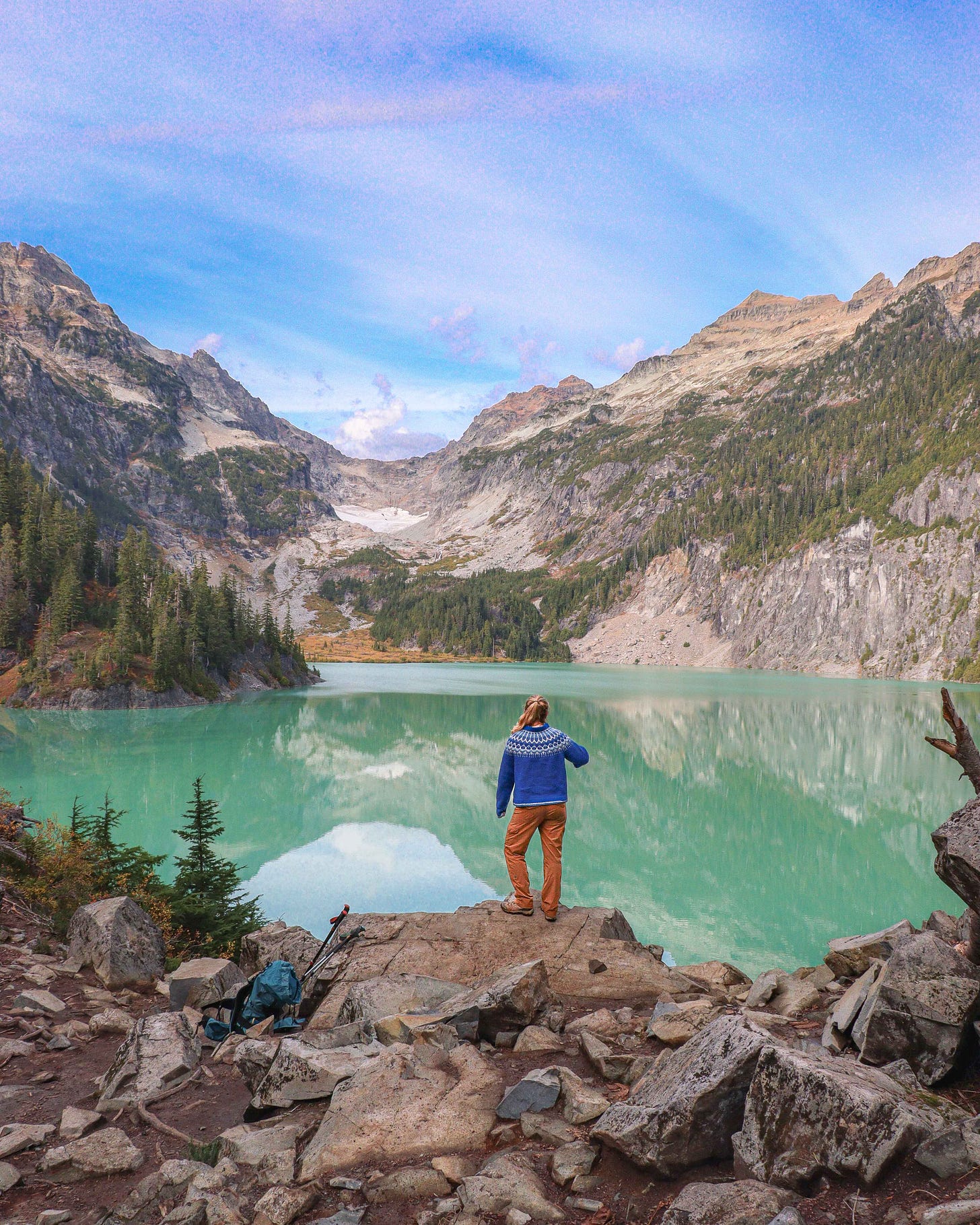
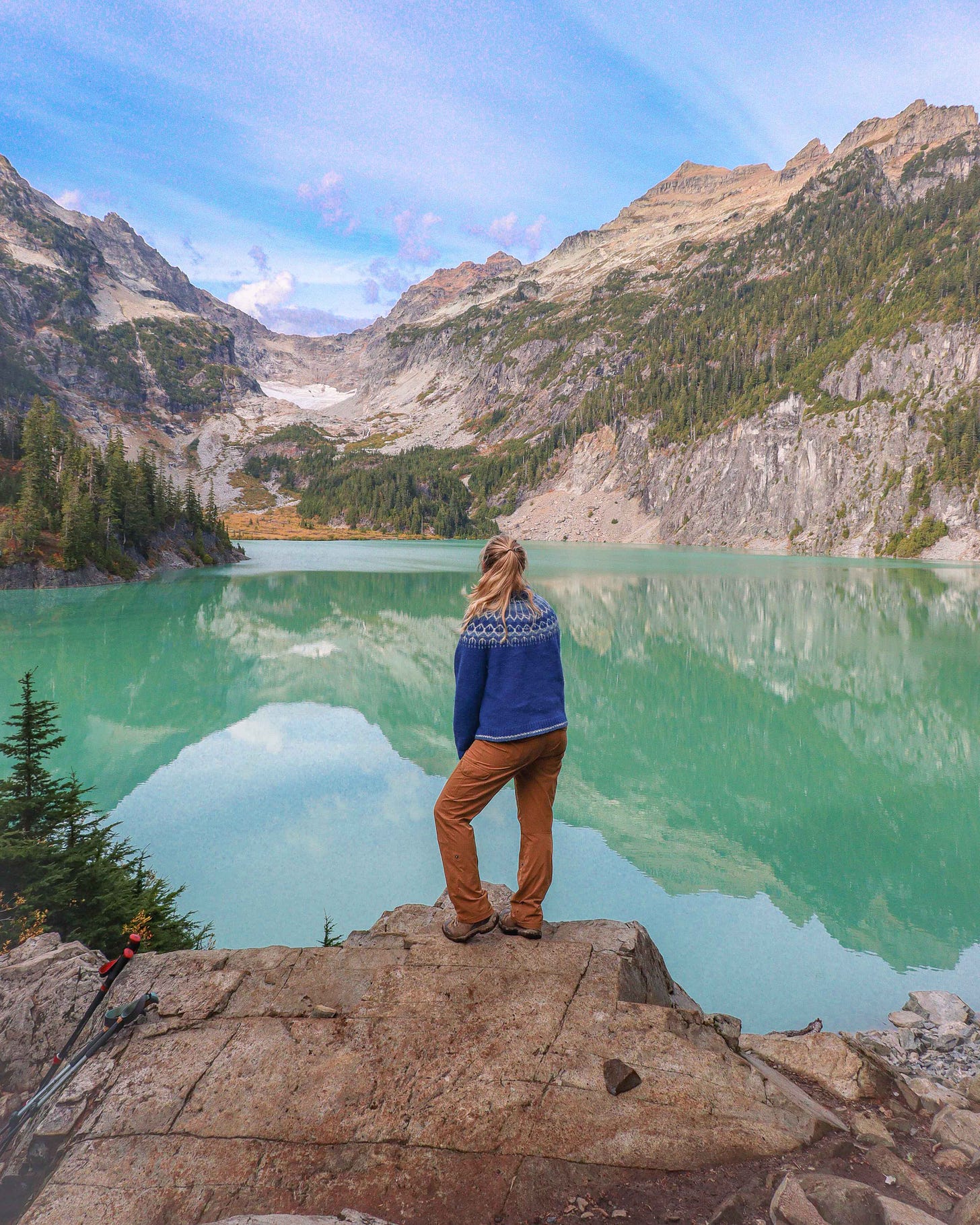
Blanca Lake coming into view is a pretty incredible experience— it really is that blue. It reminded me a lot of Avalanche Lake in Glacier National Park. In the distance, you could see glaciers and waterfalls.
Overall, I would say this hike is definitely worth the trek. Personally I don’t know if it’s a revisit for me— it’s a lot of work and the lake is definitely worth hiking at least once, but with the heavy foot-traffic you can definitely find trails with more consistent views that are less crowded in Washington State (I’m thinking of you Hannegan Pass).
Welcome to the North Cascades Twilight Zone
Though the sun wouldn’t set until 7 or so, it was about 5:30 when we noticed it was getting dark. Up at the lake it was sunny and beautiful, but as we lost elevation we could see mist below us hanging in the valleys over the Forest Service roads. The mist set in, the mountains blocked the sun, and we rapidly lost daylight winding down switchbacks towards the parking lot.
A couple of strange noises from the woods— “Hey do you know anything about Mountain Lions up this way?”
I did not. It was probably just the the half-dark, the fog, and the thick moss-covered forest, but something felt just a little off, and now we had acknowledged it out loud.
We passed a family headed up taking a rest break at a switchback, and wondered if we should have told them to turn back, it was still another two miles of switchbacks. They wouldn’t even make the ridge before dark— just the long and grueling ascent.
I’m not really a superstitious person, but then again I am. We recognized trees and landmarks on the way down, and by the time we made the parking lot my sense of unease was gone. We hopped into the car and sped down the mountain chatting.
“Hey is this the right way?” Uncharacteristically, I hadn’t brought any maps. Even more uncharacteristically, with the mist and the growing dark, I wasn’t quite sure the road was the same we’d come in on. The Cascades are a labyrinth of forest service roads. With five years of sea kayak guiding and wilderness travel experience, I consider myself to be a pretty good navigator. Something felt a little off— probably, it was just the mist and the dark. Nothing looked the same anymore. It seemed like there were more intersections than I remembered.
“I think so, yeah, turn right here.”
We passed through the five point intersection, then passed the campground I remembered seeing on the way up, then the bend in the river and my feeling of unease lifted. We had definitely come this way, I decided, and went back to talking about Olympic National Park and backcountry hot springs.
The road wound around the river, mist and yellow leaves and long indigo shadows, hugging the side of the cliff. A footbridge crossed the river and I made a mental note that I would like to return to that spot someday.
Around the next bend I hit the breaks a swerved— a rockfall halfway into the road lined with orange traffic cones.
“Was that— was that there on the way out?” I asked.
“I… I remember rockfall but I don’t remember cones,” my friend answered.
I remembered rockfall too. Maybe I hadn’t noticed the cones because I was on the side of the road that didn’t need to divert. Maybe the cones hadn’t been there on the way out. Maybe the rockfall was fresh. It was getting dark in earnest now, that sort of in-between time when when it’s still light, but in a way that makes it harder to see.
I kept driving, and we passed the second rockfall. This was definitely the way we came in, we decided— still, something felt off.
We rounded the corner and my headlights hit a sign and barricade up ahead: Road Closed to All Traffic.
“That… that can’t be right. We came in this way.”
I read the sign and reread it. “Maybe it’s new?”
“Why doesn’t it give a detour route?”
“Okay, what now?”
We pulled up Google maps, or at least, what of Google maps had downloaded before we lost cell service.
“All right… all right so I can find another way out,” my friend said. She sounded mostly sure.
“Definitely,” I said with confidence I did not have. “They wouldn’t close the only road with people back here, so there has to be another way out.”
We turned the car around and spotted two other cars we recognized from the trailhead headed the same way we came, towards the road closure. I flashed my brights and rolled down my window.
“Hey! Fancy seeing you again here!” I said, smiling to the family we’d spotted headed up the switchbacks in the dark. “The road is closed up ahead. Do you know another way out?”
“What!? Closed? No, we don’t.” The father looked panicked.
“That’s okay, no worries. We’ll find a way out!” I chirped. The good thing about a years of wilderness guiding is that I know how to instill confidence even when I have none. I had none. Navigation on the ocean is one thing— I can look at an island and tell the distance by the size of the trees, the color of them. Forest service backroads in the mist, in the dark, is another thing. Maybe a road really would close without warning. That, or we were really, very lost. Also, no map.
I pulled forward and repeated the story to the next car.
“Yeah, yeah,” the man said. “There should be a road out to Skykomish.”
“Can we follow you out?”
“Sure, let me spin around.”
We followed in the dark until he turned right on a small forest service road covered completely in leaves.
“That cannot be right,” I said aloud, but turned after him.
“Aren’t you glad you have a full tank?”
“Yes,” empathic.
The car in front of us stopped, and threw it in reverse.
“Great,” I said out loud. This guy had no clue where he was going either. All three cars backed out of the small, leaf-covered forest road in the dark on to the main, slightly larger forest service road. When the front car reached the road again, we paused for a second, to see if we should flag him down, and figure out what next. He pulled forward and continued on the main road.
“All right, I guess we’re following.”
We followed in the dark, trees backlit in the mist by an eerie grayish blue light that seemed a little preternatural, like something from a movie set, until we came to a stop at a five-point intersection.
I remembered the intersection from the drive in— we had come up, paused to read the signs, then headed up toward Blanca Lake. To the right had been the sign for a lookout. The couple in the front car turned to head up the ridge, then stopped.
“No, no that’s not right,” I said aloud. “Everything is south, we need to be headed to the lower elevations and south, that is up and north.”
“Should we hop out of the car?” My friend asked.
“Yes,” I said, as if I wasn’t nervous too, but I took the keys with me and locked the car behind us.
A five point intersection, lit only by head lights. Three groups of strangers— the couple, the family, and us. We walked over to the couple and they rolled down their window.
“It’s this way,” he pointed up.
“I don’t think it is,” the wife argued, annoyed. “The trailhead is that way, we have to be back that way,” she said, pointing south.
“Okay okay I’ve got it now,” the husband said. Throwing his car in reverse, they turned up a road labeled Lookout.
“There’s no way that’s right,” my friend said. “Lookout?”
“No, definitely not,” I agreed. I threw my blinker on to indicate we were taking a different road. They reversed again.
We were left looking at two roads to the south having eliminated the the other three— the road we came in on, the road back to the trailhead, and road to a lookout.
South, down, and the widest looking road, we decided, and drove. We wound along the dirt road in the mountain in the now true dark for about 20 minutes before it changed to paved and I have never been more relieved to see cabins. We got a spot of cell service and I was able to get a text through to Andy that we were fine, just a weird road closure.
“Maybe it was an earthquake,” I couldn’t make sense of it. All three of cars turned on the same road, the one we came in on. Three people don’t make the same wrong turn, and there had been an earthquake in the area not that long ago, I’d felt it at home. “Maybe there was an earthquake, which is why there were those rocks in the road and the cones, and the road was damaged.”
“Maybe,” my friend said, doubtful. We drove, until finally we hit the highway and then Skykomish and stopped for snacks at a gas station.
I pulled out my phone and googled road closures in the area— nothing. I checked the forest service site, and pulled up an article from 2006. My friend got back in the car. Out of date; I closed the tab.
“Hey will you look up and see if you can find anything on the road closure?”
She looked. I tried to hookup music from my car, but couldn’t get it to work. Just static. Put the car in drive, headlights glaring in the mist, roads all shiny wet.
“Hmm, that’s weird,” she said.
“What is?”
“The road’s been closed since 2006. For flood damage.”
“That’s an old article though, isn’t it?” I asked.
“No, it says repairs in 2023. Here, they’ve even got a picture of the road.”
“That can’t be right.”
“I know.”
“We came that way.”
“Didn’t we?”
We sat in silence, trying to fit the pieces together. Somewhere in the dark and the mist in the shadow of the Twin Peaks, three cars had all made the same wrong turn. Forest Roads all look the same in the dark I suppose, or rather all look so markedly different than in the light.
“We never passed that bridge,” I realized. “The one-lane bridge I paused at with the blue water and mountain view, the one I said I’d take a picture of on the way back. On the way down the mountain we didn’t pass it.”
“Oh, we did not.”
“Okay, okay. A five-point intersection in the dark. Say we all come up and note in our heads that we made a left turn to get to the trailhead, and in reverse that’s a right. But since there’s two roads to the right we all turn down the closer right, the wrong right?”
We drove further and passed Beckler Road. “Wait, that’s the way we turned in. I remember saying it over and over out loud while I was looking for it. Not Index-Galena, Beckler.”
“Are you sure?”
“Not really,” I said honestly.
We made the rest of the ride home without incident, but here’s the really wild part—
I can’t figure out what route we took on the way back. I can find the five point intersection, I found Index-Galena and the closure, and I found Beckler, but there’s no way we didn’t take Beckler both in and out based on the maps I found, and the road we finally came out on was definitely not the road we came in on (Beckler, I’m sure of it). It just wasn’t the same road, it didn’t look the same, the way up was more forest and river and campground, the way down was more paved, no river, and cabins.
And we stopped for snacks on the way home and then passed Beckler Road, I’m sure of it. I said it out loud. I don’t remember passing through Skykomish on the way in to hike either— we’d turned into the forest roads earlier.
Except that’s impossible— we must have both come in on and left from Beckler Road, because Beckler Road is east of Skykomish.
Truth is, I have no idea what happened up in those mountains that night for three cars to get so lost in the exact same way, for me to be so so sure we passed Beckler Road on the way back and so sure that the road we ultimately came in and left on were different, but for that to be impossible.
What I do know is the second we hiked down from the sunny alpine and in to the mist something felt off, and we both felt it.
Whoo! Thanks for making it to the end of that creepy little tale! No embellishments at all, that is exactly as it happened last Saturday. The Pacific Northwest is weird.
Anyway, here’s some further reading…
Looking for solid gear? Check out my gear list, tested and true through five seasons of guiding and wilderness paddling.
For my Midwest hikers, check out the 25 best things to do in the Sleeping Bear Dunes.
I’m finally getting around to creating some hiking guides for the Pacific Northwest! Check out a weekend (budget) trip to Olympic National Park and the 16 best things to do on Orcas Island.
Check out this totally free guide to photo editing: I’m sharing all my photo editing tricks for iPhone photos, RAW files, videos, and more
A little from real life lately & how we almost died on a snowy road in the mountains on friday not to be dramatic or anything but forest service roads and i are done…
Keep reading with a 7-day free trial
Subscribe to Hello Stranger to keep reading this post and get 7 days of free access to the full post archives.


