This past week, I spent four days in and around the Boundary Waters Canoe Area Wilderness, one of the most visited Wilderness Areas in the United States. I’m lucky enough to live nearby, and have done a lot of the day hikes in the area, but this was my first time checking out some new trails and areas.
From day hiking at Magnetic Rock, to paddling to Rose Falls, to backpacking a section of the Border Route, here’s the trail conditions and trip report:
Magnetic Rock Trail
Magnetic Rock trial is a 2.5 mile out and back hiking trail with a trailhead directly on the Gunflint (the paved road that winds through the area and divides the Boundary Waters). The trail is beginner friendly, and ends at “Magnetic Rock”, a 30 ft tall hunk of Iron that you can stick a magnet too.
It’s awesome, and feels like a standing stone out of some kind of fairytale.
In general, I’ve heard from a lot people that Magnetic Rock Trail just isn’t as scenic as a lot of the other places around the Gunflint/North Shore.
I humbly disagree:
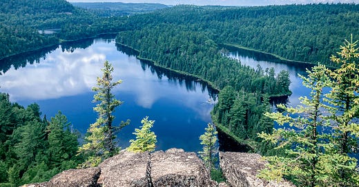
The Magnetic Rock Trail is a really cool spot for views of the boreal forest itself, and to appreciate what a forest looks like as it rebounds from wildfire.
As for photos of the rock itself, I think I’ll leave that a mystery. Some places are meant to be experienced, not viewed, and Magnetic Rock is definitely one of them.
Trail Conditions: Magnetic Rock is well-maintained, well travelled, and had aggressive flies and mosquitos in late June. Signs of beaver. The Magnetic Rock Trail also acts as the western terminus for the Border Route Trail.
Paddle/Hike to Rose Falls
Rose Falls is one of those bucket list day trips that I will absolutely be repeating. Tucked away on the Stairway Portage between Duncan and Rose Lakes in the Boundary Waters, Rose Falls is a really beautiful Cascade.
You can reach Rose Falls either through a brutal (beautiful) trek on the Caribou Rock Trail, or by paddling.
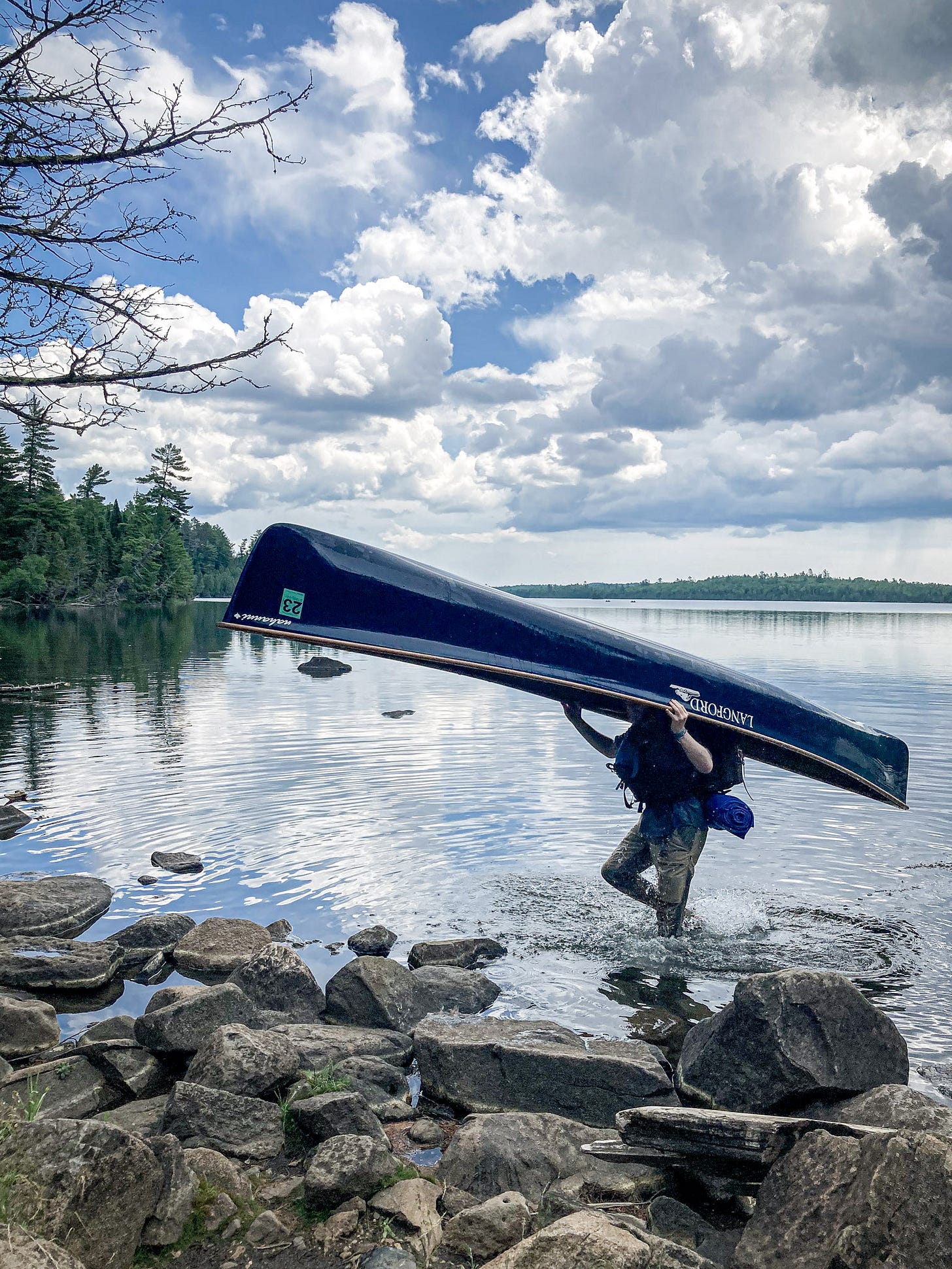
This is what portaging looks like in the BWCA. The Duncan Lake Portage isn’t especially difficult, but I would also not say it’s beginner friendly if you’ve never portaged a canoe.
The route I recommend is to start on Bearskin Lake and paddle the north side until you reach the Duncan Lake Portage. Portage to Duncan Lake. Then, paddle northeast on Duncan Lake until you reach Stairway Portage. From here, you can hike up the Portage to the Falls.
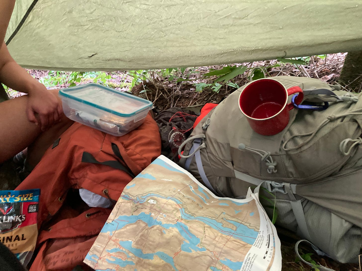
I recommend McKenzie Maps for navigation/routefinding in the BWCA. You can find the topographic information for this trip on no. 2, E. Bearskin Lake map.
Trail Conditions: Permits are required in the BWCA, even for day use. This is a moderate day trip that will probably take the better part of a day. I would not recommend this paddle/hike for large groups (limit 9 people in 4 boats in the BWCA). Route finding is fairly easy, and the paddle hike can reasonably be completed in anywhere from 4-6 hours depending on paddling experience/time at the falls. On the water in late June, bugs were not an issue.
Rose Falls is again, one of those places where I feel like experiencing it isn’t anything that can be conveyed in a photo. It’s pretty incredible to come from Duncan Lake and look out over Rose Lake through the trees, and hear Rose Falls and go find it.
The Falls are also much larger than they appear in any picture (at least any picture I took). I really do recommend that you go out there and experience it for yourself.
The Border Route: Daniels Lake to Mountain Lake
Now for the Border Route!
The Border Route Trail is a 65 mile, rugged and unmaintained hiking trail that runs through the Boundary Waters along the US-Canadian Border. It can be difficult to navigate both in that the trial itself can be hard to find and follow, and that sections of the trail are in ankle deep mud, scrambles up ridges, and involve large swarms of Mosquitos.
The reward, of course, is some of the most incredible views of the Boundary Waters-Quetico.
Before I even begin I want to head this off with this is not a beginner backpacking route (though I will suggest an easier alternative). I needed to shoot a bearing/use a map to find the trail more than once, we got caught on a ridge during a storm and had to find a safe spot to hunker down, the trail is extremely rugged, difficult to hike, and difficult to follow. There are limited camping options and you have to camp at a designated BWCA campsite.
There is no cell service, a risk of afternoon storms on exposed terrain, and you will likely see very few other people. We did not see one other person on the trail in two days.
I recommend McKenzie Maps for navigation in the BWCA. You can find the topographic information for this trip on no. 2, E. Bearskin Lake map. You will also need a good compass, and practice find your location using a compass and known points on a topographic map.
The Start of the Trip:
Sydney and I knew each other in college, and when we realized we were both in the same small town met up for coffee. I halfheartedly mentioned that I really wanted to backpack part of the BRT this year, and she said that sounded fun! (Sorry Sydney)!!
Less than a week and ample prep later, we hopped on the Daniels Lake Spur Trail to the Border Route.
The Daniels Lake Spur (pictured above) is a flat and easy trail to follow. The beginning however, does feature some lovely ankle deep mud. There are two campsites along Daniels Lake.
After a few miles on the Daniels Lake Spur, you’ll join with the Border Route Trial. From here, you could head northwest out to Rose Lake, eventually to Rose Falls and then up the Caribou Rock Trail to be picked up at Hungry Jack Lodge. That would also be a pretty cool trip.
Instead, we headed east to Rove Lake. This first section of the trial on the Daniels Lake Trail and along Rove Lake is fairly flat and easy. Everything is clearly marked. Near mile 5/ the end of Rove Lake, the trail will become rockier, muddier, and a real risk for an ankle twist.
As the trail cuts inland around mile six, you will quickly begin to climb. This section of trail is more difficult. Shortly, you’ll reach the spur to the 2-mile campsite on Clearwater Lake.
(If you’re looking for that easier backpacking trip around 15 miles total, I recommend camping here and day hiking up the ridge.)
Rather than take the Spur Trail to Clearwater Camp, we headed up the ridge to the Watap Cliffs, overlooking Watap Lake and Canada.
Clearwater Ridge and Watap Cliffs on the BRT:
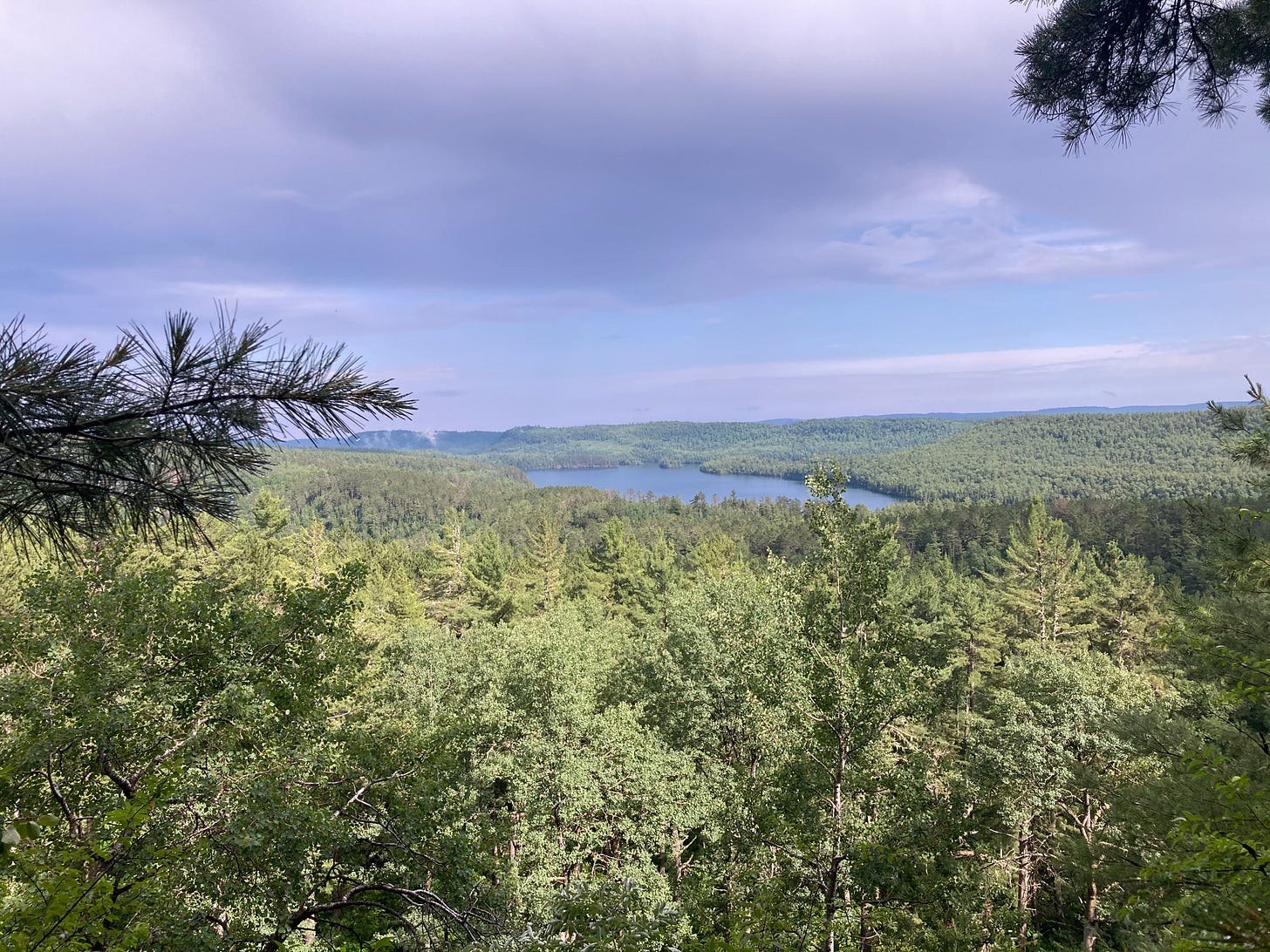
Watap Cliffs are seriously the highlight of this whole section of trail. You can find them about a mile (a difficult mile!) from the turnoff for the Clearwater Spur Trail.
Watap Cliffs are west facing, making them a great potential sunset spot, but I would caution that the trail back down to Clearwater Camp could be treacherous (if not stupid) to hike in the dark, and it is illegal to camp outside of a designated campsite in the BWCA. I do believe some exceptions are made for thru-hikers specifically, but I would call the forest service to double check.
At this point, we had hiked around 8 miles and it was just after 1pm, so we decided to push on to our goal campsite near the end of Clearwater. The section of trail from this point forward gets considerably more difficult and overgrown as you hike along the Clearwater Ridge.
At around 2pm on at approximately the center of Clearwater Ridge, we got hit by a few storm cells and hunkered down in a downpour for about two hours. I’m a big tarp person for this reason. It’s much easier to throw up a tarp to hang out under than it is a whole tent, and it’s much more comfortable to sit under a tarp than to shiver in your rain gear, especially if it’s un-hikeable.
Sydney and I at this point had an interesting choice to make from a risk management perspective. We were between storm cells on a ridge, but had already found a somewhat safe and low-lying point to wait out an electrical storm. It would be two miles down the ridge in either direction, and we could hear a loud storm approaching by thunder increasing in volume and frequency, but had no real way of knowing exactly how long we had to try and hike down off the ridge. We also didn’t know what trail conditions looked like moving forward, but we figured using dead reckoning that we were likely much closer to descending the ridge on the side we hadn’t yet hiked than to go back through Watap and down to 2-mile site on Clearwater.
So: You’re on a ridge, in a safe spot, and there’s a window between two storms and a chance for you to get off the ridge to an even safer spot. But you don’t know the trail ahead other than it’s rugged and notoriously hard to follow. It’s currently raining and you’re dry. A second storm is approaching and you reckon you have about one mile to go until you're off the ridge, and a half hour until the storm hits, which is about on pace for you on this trail so far.
What do you do?
We packed up slowly in a lull in the rain, stalling a decision. A large clap of thunder pretty much as soon as we stepped on trail and we decided to wait it out under the tarp. The storm was closer than we originally thought. Back to our little hideaway.
The second storm was more electric than the first, but passed quickly and we hopped back on trail.
Speaking of the trail, this is what it looked like…
(all of my photos from this trip are iPhone. Having some technical difficulties with the Canon)
We made it out to Mountain Lake Overlook (above) where we briefly lost the trail completely— Mountain Lake Overlook is a spur trail it turns out, not a trail itself. We hopped back on the BRT, scoped out a campsite on Clearwater Lake (it did involve us hiking a short distance in the water).
The next morning, we got up early for breakfast on Mountain Lake, then made it our goal to get back to the car (13+ miles) before 3pm to reduce our chance of getting caught in an afternoon storm. We made it back by 3:20, so not too bad.
Trail Conditions:
The Border Route is rugged. It’s a great experience for someone looking for a challenge, but it was certainly a challenge. Bugs were bad in the interior, but tolerable on the lakes and on cliff overlooks themselves.
I wore the Simms BugStopper leggings and had pretty good luck with them. I did still get a few mosquito bites on my legs, but 4 compared to the 40 bites on my arms is nothing. I also had/saw no ticks.
Next week I’ll be sharing/reviewing some of my favorite backpacking/paddling/outdoor gear, so if you don’t want to miss that click the handy little button below if you haven’t already!


