


best fall hiking you've never heard of
off-the-beaten-path on Minnesota's North Shore

After spending two wonderful autumns hiking Minnesota’s North Shore, I can confirm that the region north of Duluth has the best fall hiking trails in the Midwest. From peaks overlooking blue lakes, to waterfalls, here is the best fall hiking on Minnesota’s North Shore:
Best Fall Hiking on Minnesota’s North Shore 2023:
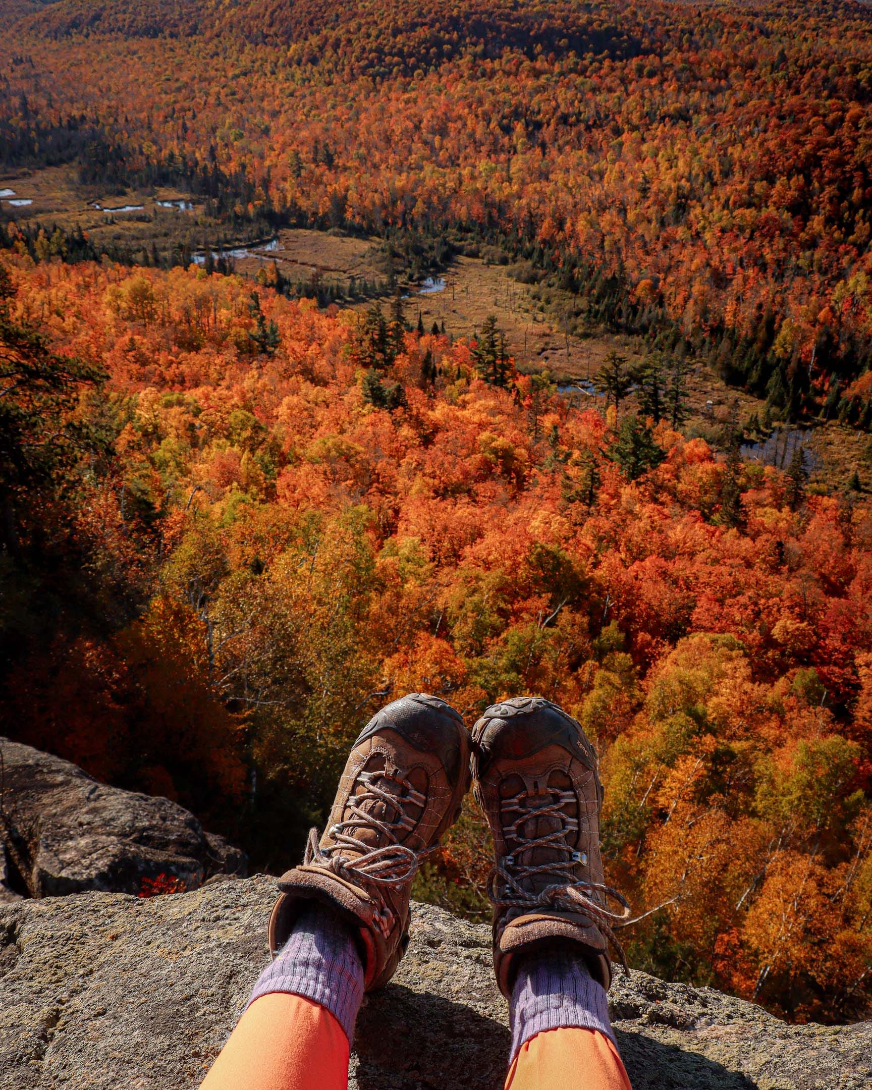
My first autumn up here, I hiked a lot of the more popular hiking trails. My second fall, I ventured a little farther off the beaten path. This list will mostly include the lesser travelled, greater reward paths. If you like solitude on a trail, rewarding views, and blisters, read on!
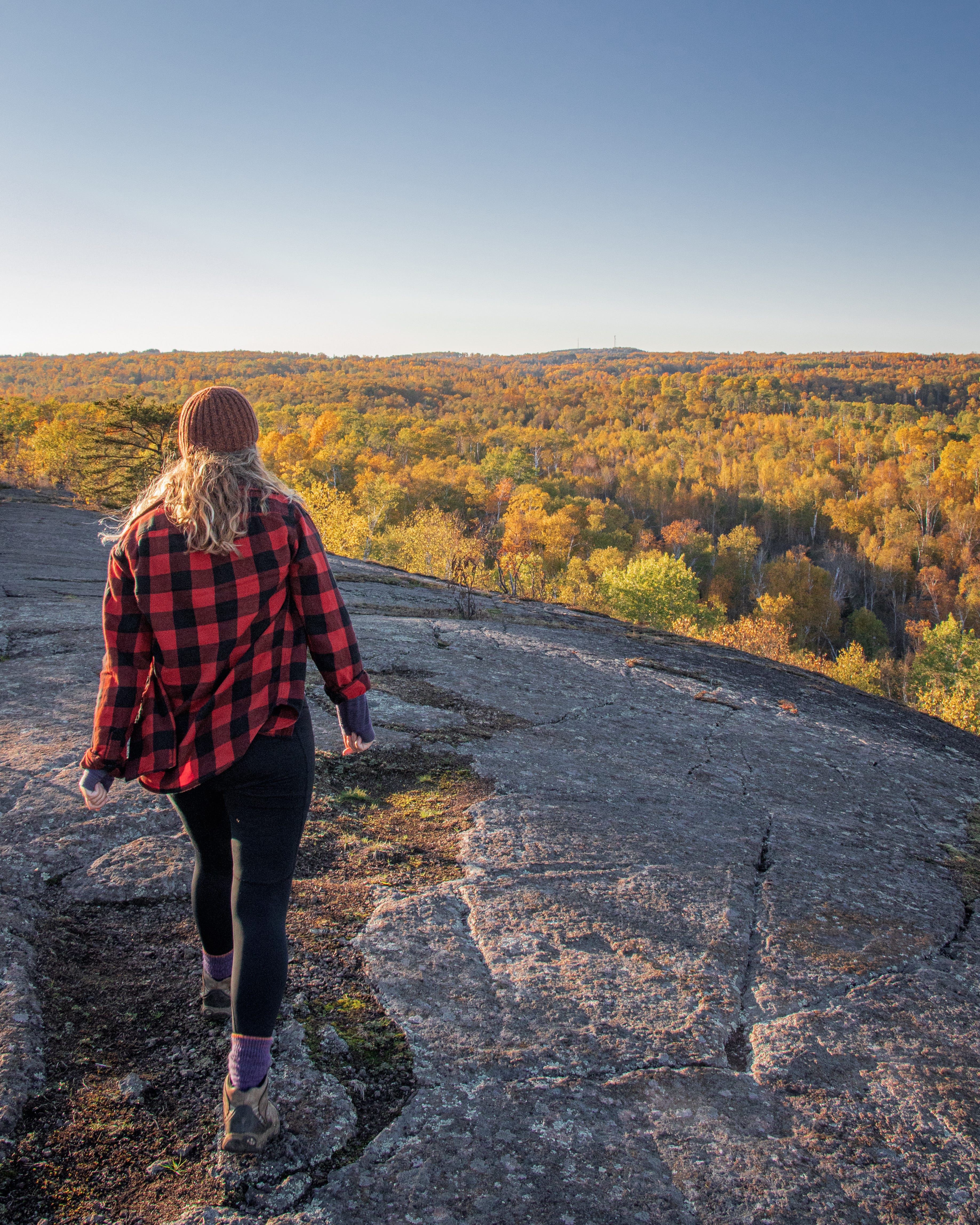
Mount Trudee via Tettegouche State Park
I stumbled upon Mount Trudee the way I stumble upon most things— pouring over a topographical map and making a little star on a place I want to check out. Some of the time it’s a total bust, and I hike a really long way just to find slippery trails and overgrown lookouts.
For the elusive Mount Trudee this was not the case.
It took me three tries to get to Trudee— the first attempt I tried to swing in just a two hour window from the inland Tettegouche trailhead and I ran out of time and didn’t make it. The second attempt I tried from the Lax Lake Road Parking lot— I hiked about 11 miles around the various trails there to map out the previous route, and didn’t have the time or juice to add another four miles out to Mount Trudee.
The third time Trudee was my singular goal. I hit the trail immediately after work and ate lunch while I walked. I stoped at the beautiful Palisade Valley Overlook, before half jogging, half climbing the Trudee Summit. It was incredible. Easily top five overlooks on the North Shore for me (Rose Lake, Watap Cliffs, Trudee, Fantasia, Poplar Valley?).
To get to Trudee, you can either start from Lax Lake Road for about a 12 mile hike with a detour to Palisade Valley and all of the smaller overlooks along the way. I would consider this route to be generally difficult. For an easier (but definitely not easy) route, start at the inland Tettegouche Parking Lot and cruise the SHT for closer to six miles round trip— this route cuts out the Palisade Valley Overlook which is half the fun. Trudee is especially awesome in the same way that Rose Lake Cliffs are— there is no easy way to get to it.
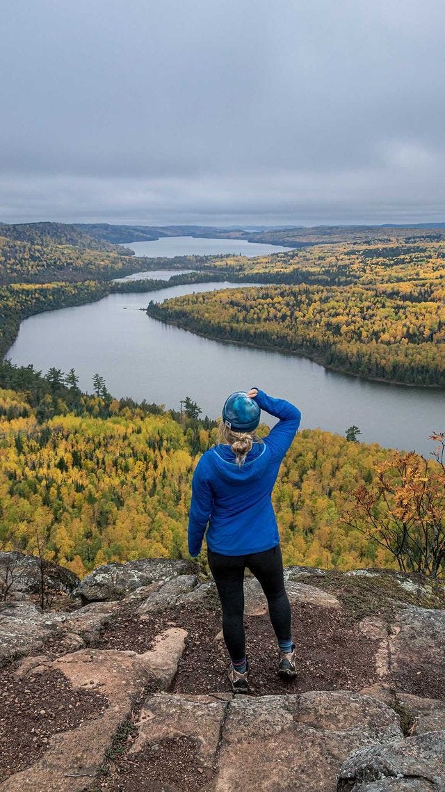
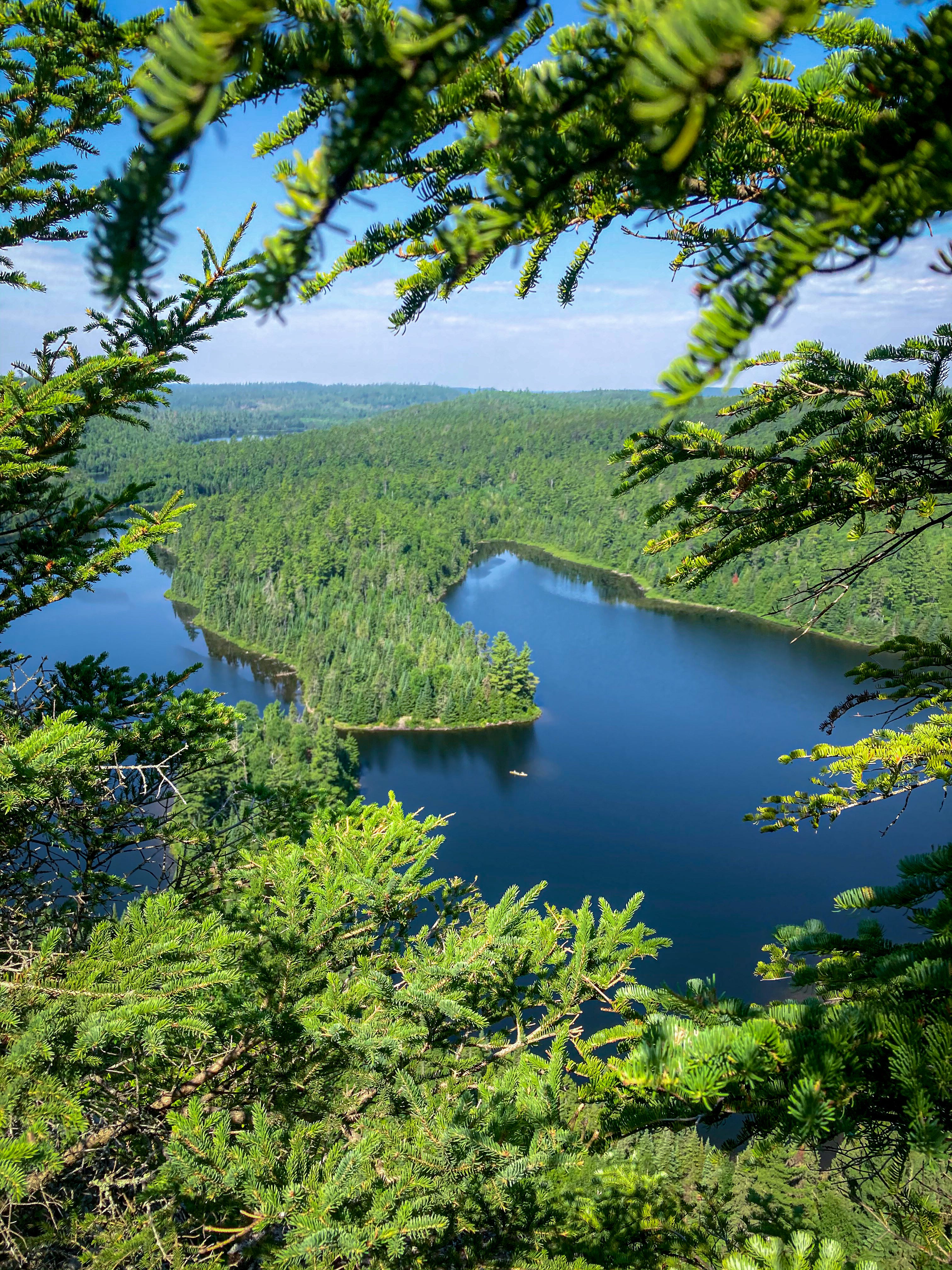
Rose Lake Cliffs on the Border Route Trail
The Caribou Rock Trail is probably the single most difficult trail in Minnesota— pair it with a section of the Border Route Trail, another notoriously difficult Minnesota Trail, and you’ve got the hike out to this beautiful overlook:
Video from Rose Lake Cliffs
Before you hit the trail read this full trail guide. It’s about 13-14 miles round trip, over pretty unforgiving ups, downs, and ankle twisters. While we usually make 25 minute miles on trail, our pace was a 40 minute mile here. There is no cell service in the BWCA. It is a 1+ hour drive from Grand Marais to get to the trailhead. Permits are required. I strongly strongly recommend a GPS with two-way communication and/or Sat phone. This hike will take the entire day— but it is worth it. Permits are required in the BWCA.
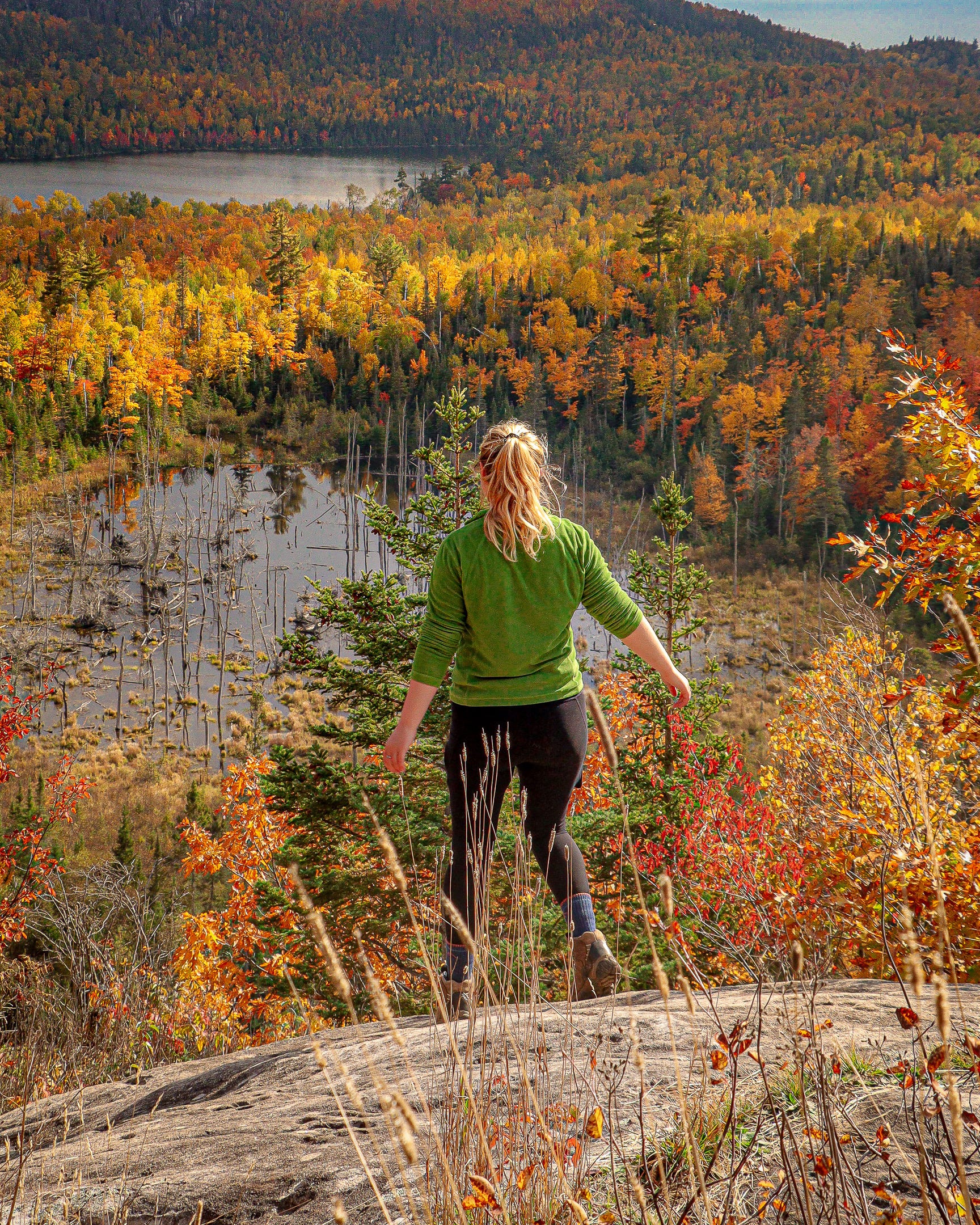
Mount Baldy and Nicado Lake
Mount Baldy is a relatively little-known trail tucked away in the backside of Tettegouche. Parking is available off Lax Lake Road. There are no bathrooms at the trailhead, limited parking, and no trash can (read: this is probably not the place to make an itinerary-style social media post about because it is not set up to support a sudden influx of tourism).
That being said, portions of this trail are overgrown and could probably use more foot traffic from intrepid hikers, similar in that way to the Border Route Trail.
Mount Baldy can be reached through an almost three mile moderate out-and-back, or as part of a loop out to Tettegouche Lake Camp, where there are pit toilets and backcountry cabin rentals available.

video of the overlook from Nicado Lake
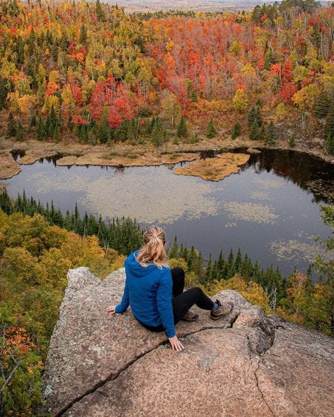
Fantasia Overlook and Johnson Lake
North of Tettegouche State Park along the Superior Hiking Trail, summit a mini-mountain to reach Fantasia Overlook, a lovely little outcropping over a beaver pond. This is a moderate-difficult hike up, and a quick hike back down, but the views from the Spur Trail of Palisade Head below are well worth it. Continue to Johnson Overlook for a 5-6 mile trip.
Pincushion Mountain
A quick, five-minute drive from Grand Marais, Pincushion Mountain was one of my favorite hikes in town. I was there about once a week when I lived in town, and haven’t shared it before for that reason (ie, I don’t want people to know if there’s a trail I’m on three nights a week).
Pincushion is a four-mile hike, and relatively flat. Be sure to leash dogs as unleashed dogs have been known to be bothered by the local wolf pack (don’t stress! The wolves won’t bother humans!). This hike ends at a lovely northeast-facing overlook of Lake Superior and the hills to the North. For more, continue along the SHT into the Devil Track River Canyon. I like to have lunch on the Bridge before heading back.
You’ll almost definitely be able to find parking here— it’s got a sizable parking lot with bathrooms, and I’ve never seen the lot anywhere near full.
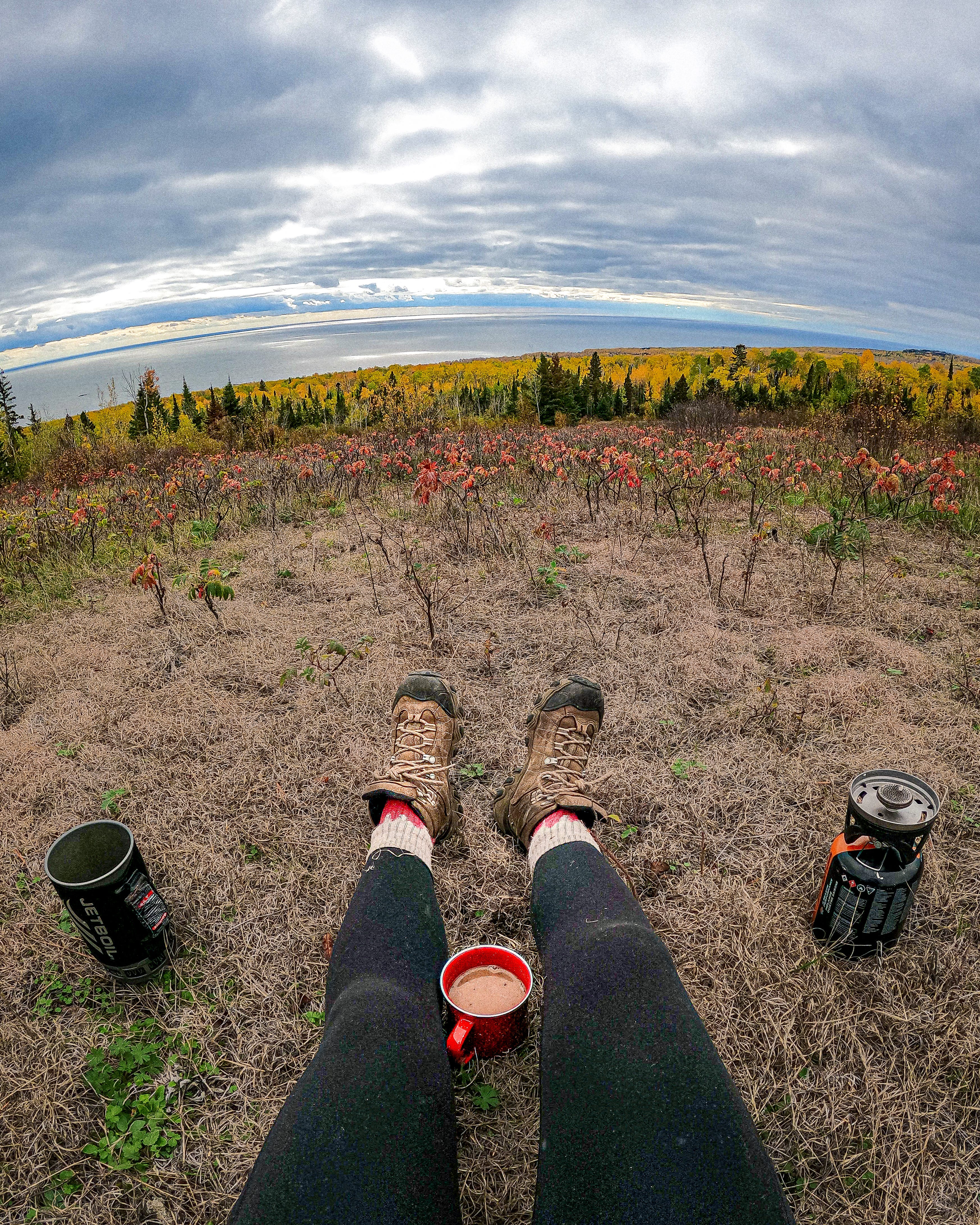
Watap Cliffs and the BRT
The single best trail along the Gunflint Trail and in the BWCA is the Border Route Trial. The BRT is a 65 mile trail and potential thru hike through the Boundary Waters Canoe Area Wilderness. This trail can be overgrown, rugged, and incredibly challenging. That being said, it offers some of the most impressive views in the state of Minnesota, if not the Midwest.
Most hikers tackle the BRT in 5-7 days, but there are definitely options for shorter routes and loops. I recommend McKenzie Maps for route planning as they tend to be most accurate.
Potential shorter routes include a 21-mile loop including the Moss Lake Portage Trail, Rose Falls, and the Caribou Rock Trial, a point to point from Daniels Lake Spur to Rose Falls, to the Caribou Rock Trail, and (my personal favorite and pictured above) a trip up the Daniels Lake Spur to the Clearwater Ridge and the Watap Cliffs, pictured above.
The Border Route Trail contains some of the best overlooks in the BWCA, and probably some of the best overlooks in the BWCA, rivaled perhaps only by the Superior Hiking Trail near Tettegouche State Park and Temperance State Park.
Magnetic Rock Trail
If you’re looking for your Outlander moment, head up the Gunflint Trail to Magnetic Rock for a beautiful hike over interesting rock formations, past several overlooks, and out to the mysterious 30-ft tall standing stone at the edge of the Boundary Waters. Yes, it is magnetic.
This trail winds through the remnants of the Ham Lake Fire, giving it a very tundra-eque look to it. Plant-life is rebounding, but you can see wildlife and views far and wide in most areas.
High Falls on the Baptism River
High Falls can be reached both from the inland parking lot and from the visitors center. Currently, the bridge across the Baptism River is out, so you cannot cross the river from the trail.

I recommend the three-mile round trip route out to High Falls from the visitor’s center for the best views. This trail has several erosion zones where it is important that visitors stay on the designated trail. Most of these are apparent; if it looks like the park does not want you walking there (ie, boardwalks and railings indicating where you are supposed to walk or a sign that indicates where the trail is), stay on the designated trail. The most notable of these is near the top of High Falls. Keep in mind that boardwalks are not there to keep your boots clean, but to prevent further erosion on the trail. Best practice is to walk directly through the mud when applicable, and never leave boardwalks when available.
Grand Portage
Head as far north as you can go without crossing the border to catch the earliest fall show. Hike Mount Rose in Grand Portage National Monument for views of the historic fort below, Grand Portage Island, and even Isle Royale National Park on clear days. An easy, paved hike with some uphill.
Head up to Grand Portage State Park and trek out to High Falls to see one of the biggest waterfalls in the Midwest.
more Midwest Hiking Trails…
Check out the 16 Best Fall Hiking Trails on the North Shore
Looking for detailed hiking guides, paddling guides, free campsites, sea caves, and more!? Check out the Midwest Adventure eBook Bundle
Check out the 18 Best Hiking Trails on Lake Superior
Find an organized master list of my free trail guides below:
Trail Guide Link List
·
This is a master list of all of the hiking/travel articles I’ve created sorted by region! I like to keep trail information as free as possible 100% of the time, but for a more detailed hiking/camping guide for the Great Lakes Region check out my book,
